

This interactive map, developed by LUC for Historic England, is part of a research project exploring risk levels posed by climate change on designated coastal heritage assets.
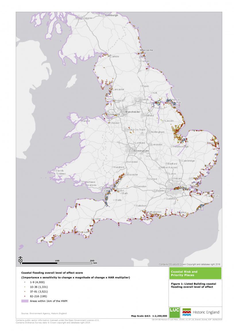
Indices of coastal vulnerability and heritage sensitivity were developed through a review of currently available data and research. These were then developed into a mapping tool to look specifically at coastal erosion, coastal flooding and sea-level rise.
Identification for adaptation
The project built on previous research carried out by Historic England. LUC incorporated the latest environmental datasets and extended coverage across all assets in the NHLE (National Heritage List for England), which includes Listed Buildings, Registered Parks and Gardens, Scheduled Monuments, and World Heritage Sites.
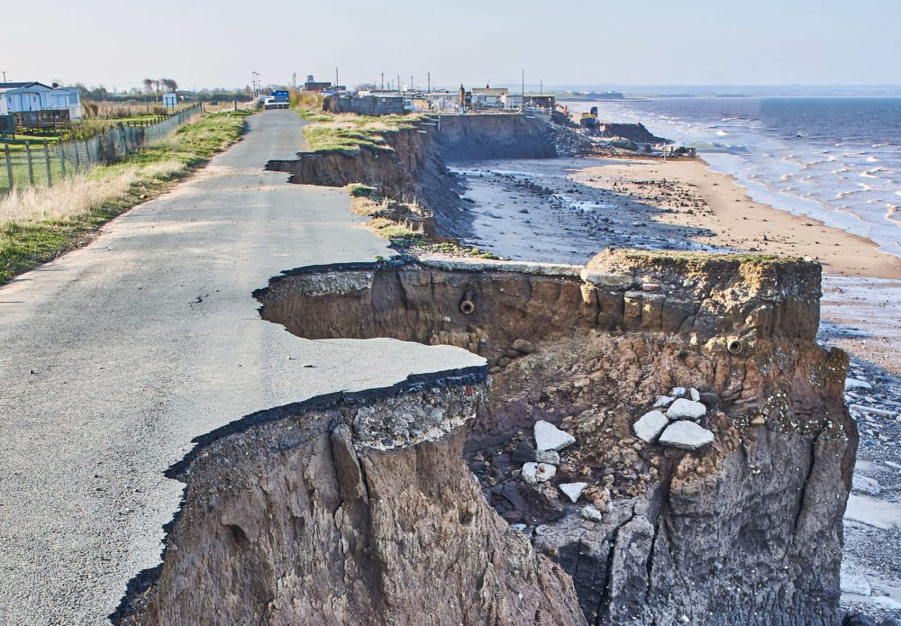
The work has allowed Historic England to identify coastal heritage ‘priority places’ – areas where designated heritage assets are most at risk from coastal processes. This has revealed that the South East and South West have the largest number of assets at risk. In terms of the proportion of assets affected, coastal flooding poses the greatest threat, with many assets being situated in flood zones.
The research looks at risk over the short- (0-20 years), medium- (20-50 years) and long- (50-100 years) term. This reflects the time horizons referenced in UK climate projections to ensure that the impacts of climate change are considered, and action can be prioritised.
Developing data for the future
Execution of this research project presented a number of challenges in terms of data access, data structure, and scoring heritage sensitivity. The project highlighted that data on environmental risk factors such as coastal flooding and sea level rise under different climate scenarios is not readily available. In some cases, data exists, but it is not freely accessible to those wanting to assess risk to their portfolio of assets.
Often climate change impacts will not be a gradual process. Further research is needed to understand where the ‘tipping points’ lie for different assets. While this study has explored vulnerability of different assets, whether an asset experiences gradual or catastrophic loss relates to wider factors such as geology, location, and materials. These are subtleties that have not been exposed through this study and further work is needed to understand this.
Towards adaptation options
Mapping and identifying priority places will enable a move towards deciding on adaptation options. The shape, size and location of the site, the fluidity of its boundaries, and the relationship of its ecosystems to one another, are all key factors in determining adaptive capacity of a heritage site
Indices of coastal vulnerability and heritage sensitivity were developed through a review of currently available data and research. These were then developed into a mapping tool to look specifically at coastal erosion, coastal flooding and sea-level rise.
Identification for adaptation
The project built on previous research carried out by Historic England. LUC incorporated the latest environmental datasets and extended coverage across all assets in the NHLE (National Heritage List for England), which includes Listed Buildings, Registered Parks and Gardens, Scheduled Monuments, and World Heritage Sites.
The work has allowed Historic England to identify coastal heritage ‘priority places’ – areas where designated heritage assets are most at risk from coastal processes. This has revealed that the South East and South West have the largest number of assets at risk. In terms of the proportion of assets affected, coastal flooding poses the greatest threat, with many assets being situated in flood zones.
The research looks at risk over the short- (0-20 years), medium- (20-50 years) and long- (50-100 years) term. This reflects the time horizons referenced in UK climate projections to ensure that the impacts of climate change are considered, and action can be prioritised.
Developing data for the future
Execution of this research project presented a number of challenges in terms of data access, data structure, and scoring heritage sensitivity. The project highlighted that data on environmental risk factors such as coastal flooding and sea level rise under different climate scenarios is not readily available. In some cases, data exists, but it is not freely accessible to those wanting to assess risk to their portfolio of assets.
Often climate change impacts will not be a gradual process. Further research is needed to understand where the ‘tipping points’ lie for different assets. While this study has explored vulnerability of different assets, whether an asset experiences gradual or catastrophic loss relates to wider factors such as geology, location, and materials. These are subtleties that have not been exposed through this study and further work is needed to understand this.
Towards adaptation options
Mapping and identifying priority places will enable a move towards deciding on adaptation options. The shape, size and location of the site, the fluidity of its boundaries, and the relationship of its ecosystems to one another, are all key factors in determining adaptive capacity of a heritage site
Overview
-
Project Name
Exploring Climate Change Risks for Coastal Designated Heritage Assets
-
Location
England
-
Category
Research, documentation and publication
-
Landscape Architect
LUC
-
Client
Historic England
-
Brief
The purpose of this project is to identify heritage assets of greatest sensitivity to coastal change - coastal heritage ‘priority places’ - for use by Historic England and made available as a publically accessible web GIS map for use by other interested organisations and individuals
Details
-
Project Team
LUC
-
Local planning authority or government body
Historic England
-
Year Completed
2021
-

LUC
Registered Practice - (21 + Employees) -
Approximate Map Location

Location
England
-
Share


